Maps and Apps
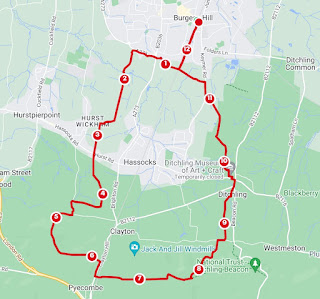
So far, I've plotted my routes after the event with MapMyWalk to share with you but traditionally I would never leave the house without an Ordnance Survey map. More recently, I've used the OS map app when on the move.
There are some advantages for a lady like me. I'm not bad at reading a map. I've never been a scout but I know how to tell a hill from a valley, a footpath from a bridleway and a pub from a post office. The app has the benefit of being accessible and not unwieldy in the wind and rain, shows my location and I can zoom in without having to find the reading glasses. It's important to me to know I'm not trespassing. I do like a big analogue map for planning though. If you get used to using maps, you do get a feel for how long things are going to take you and how interesting a walk might be.
As the saying goes, "there's an app for that". It would be unwise to rely entirely on a battery device with a signal but it's clear that for tracking routes, recording terrain and distance, they can be very handy.
I've come to realise that there are number of options that may help me. the free and paid options differ, some are more sporty or community based than others. I hope to look at the following, in the next few weeks:

Comments
Post a Comment